
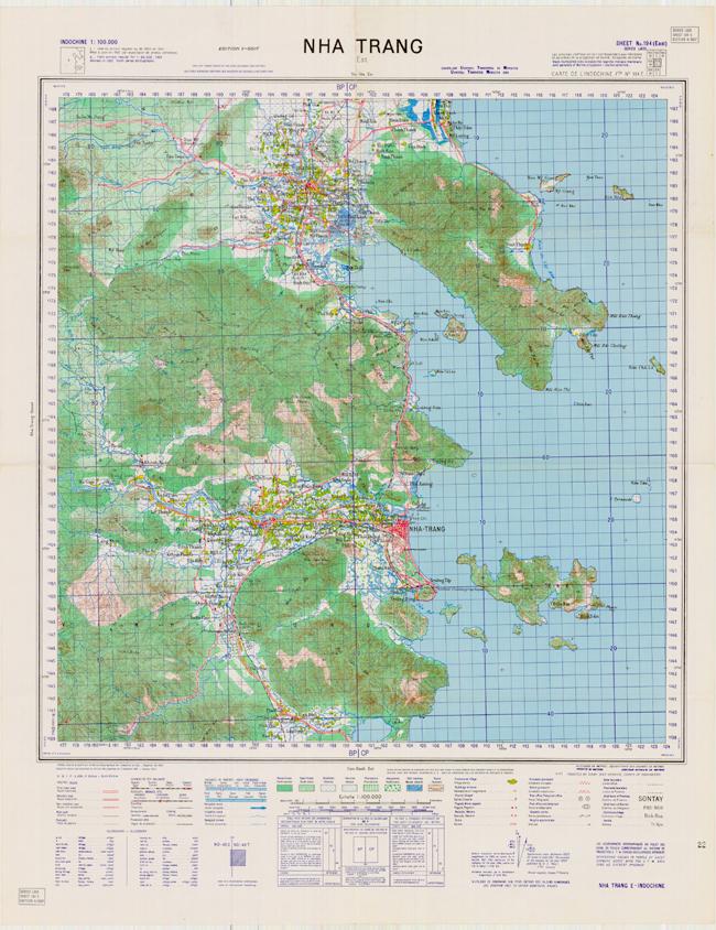
Nha Trang
Map Item Number: MAP12120502
- Pages
- 1
- Media Type
- Map
- Author(s)
- Service Geographique de l'Indochine (1931 ; reissued 1953)
- Physical Location
- Section 12, Drawer 12, Folder 05
- Language(s)
- French English
- Collection
- John B. Hyde Collection




- Map Number
- MAP12120502
- Country
- Vietnam
- Alt. Name
- South Vietnam
- Series
- L605
- Edition
- 6-SGIF
- Primary Language
- eng
- Secondary Language
- fre
- Additional Language
- eng
- Scale
- 1:100000
- Location Area
- Maps Section
- Section
- 12
- Drawer
- 12
- Folder
- 05
- Author
- Army Map Service
- North Latitude
- 12° 32'
- South Latitude
- 12° 06'
- West Longitude
- 108° 56'
- East Longitude
- 109° 22'
- Copies
- 1
Dates
Existence: April 1963Existence: Majority of material found within 01 January 1924 - 01 April 1963
- General Note
- Series L605 ; Sheet No. 194 (East) SGIF L-605 Sixth Edition = Carte de l'Indochine File No. 194 E. ; Edition 6-SGIF
Compiled, drawn and published by Service Geographique de l'Indochine 1931 - Reissue 1953
Universal Transverse Mercator Grid
Printed by U.S. Army Map Service (April 1963)
- Perma Link
- https://www.vietnam.ttu.edu/virtualarchive/items.php?item=MAP12120502
- Citation
- Nha Trang, MAP12120502. April 1963, John B. Hyde Collection, Vietnam Center and Sam Johnson Vietnam Archive, Texas Tech University, https://www.vietnam.ttu.edu/virtualarchive/items.php?item=MAP12120502, Accessed 02 Aug 2026.
- Pub Credit Line
- MAP12120502, John B. Hyde Collection, Vietnam Center and Sam Johnson Vietnam Archive, Texas Tech University
- Added: 13 Sep 2005 [Updated: 14 Jul 2020]
Vietnam Center & Sam Johnson Vietnam Archive
-
Address
Texas Tech University, Box 41041, Lubbock, TX 79409 -
Phone
(806)742-9010 -
Email
vnca@ttu.edu